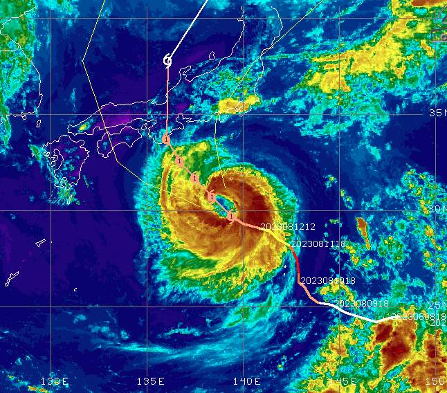
The Atlantic hurricane season usually lasts from the beginning of June to the end of October. We report on the developments of the 2023 hurricane season in this blog with ongoing updates.
Hurricane Lee passes close to the Caribbean
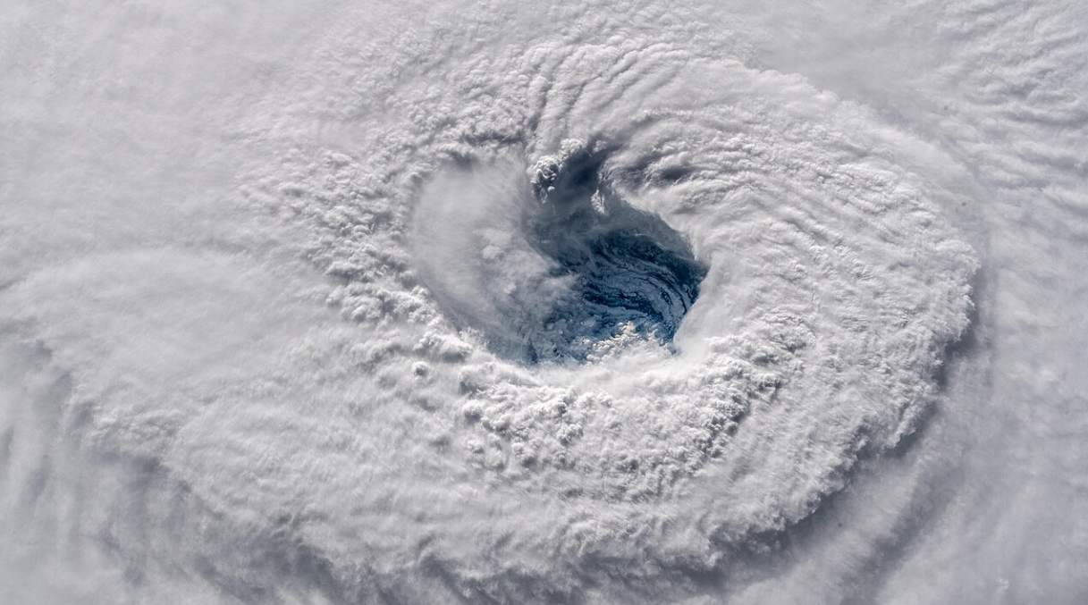
In the last update, we mentioned that the development of a new Atlantic hurricane was on the horizon for this week (see ticker evolution below). In the meantime, this hurricane has developed from a tropical depression off the coast of Senegal and is moving at around 25 km/h west-northwest. The hurricane is named"Lee". Lee is located around 1500 kilometers east of the Caribbean islands of Dominica and Martinique, in the middle of the Atlantic Ocean. The average wind speed is currently around 120 km/h, making it a weak Category 1 hurricane. Nor does it yet have a typical eye in the center (see satellite image). However, Lee will evolve rapidly over the next few days and should reach Category 4 by the beginning of the week. This means average winds of over 200 km/h and peak winds of almost 300 km/h. It's also possible that Lee could reach Category 5. The typical eye at the center of the storm will then soon be visible.
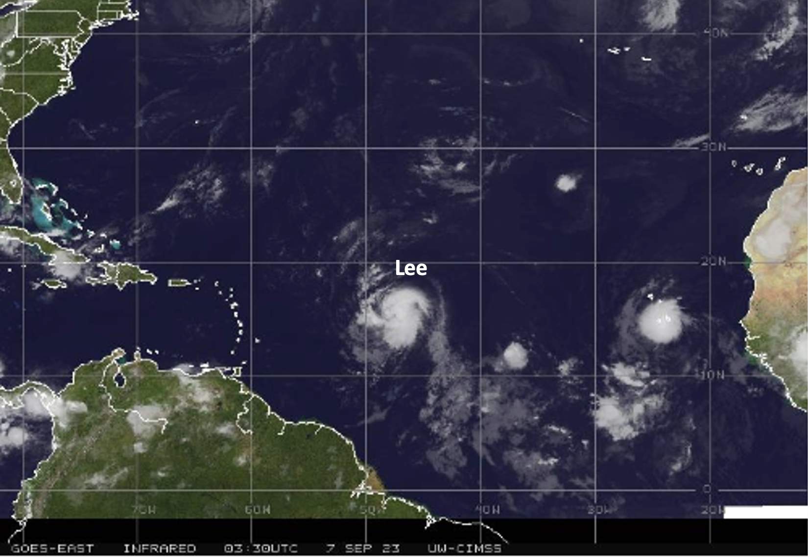
Fig. 1: Latest satellite image of Hurricane Lee.; Source: University of Wisconsin
Lee will therefore be what we call a "major hurricane". On the plus side, almost all models currently indicate that Lee will not hit the Caribbean islands or Florida. According to current calculations, Lee should move northwest early next week, some 500 kilometers north of Puerto Rico and the Dominican Republic. This development is fairly certain. Theoretically, the Bahamas and Florida would then be in its path by the middle of the week, but at present, it's rather likely that Hurricane Lee will make a turn to the north beforehand and stay over the Atlantic. Let's hope this is confirmed in this form. We'll be keeping our ears to the ground and reporting on developments here all the time.
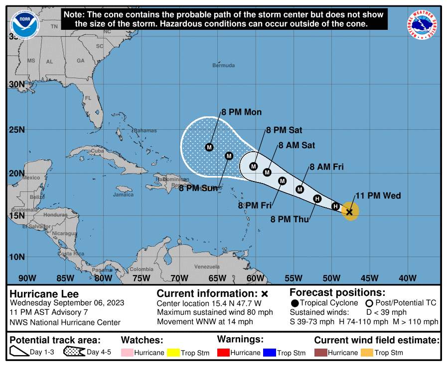
Fig. 2: Hurricane Lee's predicted evolution and path.; Source: NOAA
Currently 4 active Atlantic storms
Franklin, Gert, Idalia and Katia are the names of the storm systems currently active in the Atlantic. A few days ago, Idalia caused major damage in Florida when it made landfall as a Category 3. At present, neither Idalia nor the other storms present any danger to populated areas. What's more, none of these storms is currently at hurricane strength. The current systems are clearly visible on the satellite image.
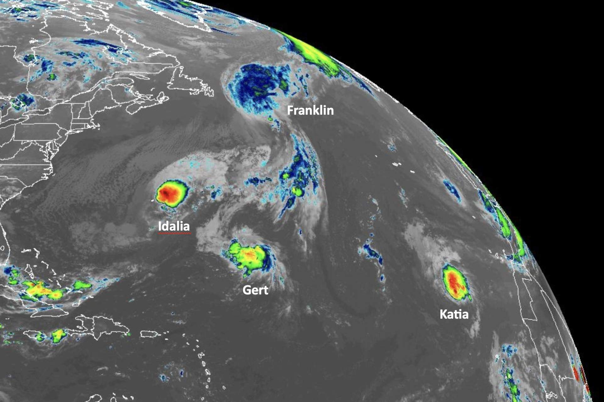
Fig. 1: Current situation in the Atlantic; Source: NOAA
Further developments next week
Until the middle of next week, the Atlantic hurricane season will be in a quiet phase. However, attention is already focused on how the situation will develop from mid-week onwards. Indications that a tropical storm will develop into a hurricane in the mid-Atlantic, around Cape Verde, are growing stronger. Given the prevailing winds aloft, its trajectory would be westward, towards the Caribbean. We will continue to monitor the situation with further updates.
Hurricane Idalia once again weakened to a tropical storm
Hurricane Idalia made landfall shortly before 14:00 (CET) or shortly before 08:00 (local time) in the "Big Ben" region, just southeast of the capital Tallahassee, in the US state of Florida. In the eyewall, peak winds reached just over 250 km/h as it fell to earth, and the average wind over one minute was quite exactly 200 km/h. So Idalia didn't need much to reach category 4 (209 km/h). In the end, Idalia was a Category 3 hurricane. The hurricane caused storm surge up to 5 meters high on the coast. In addition, several hundred thousand homes are currently without power.
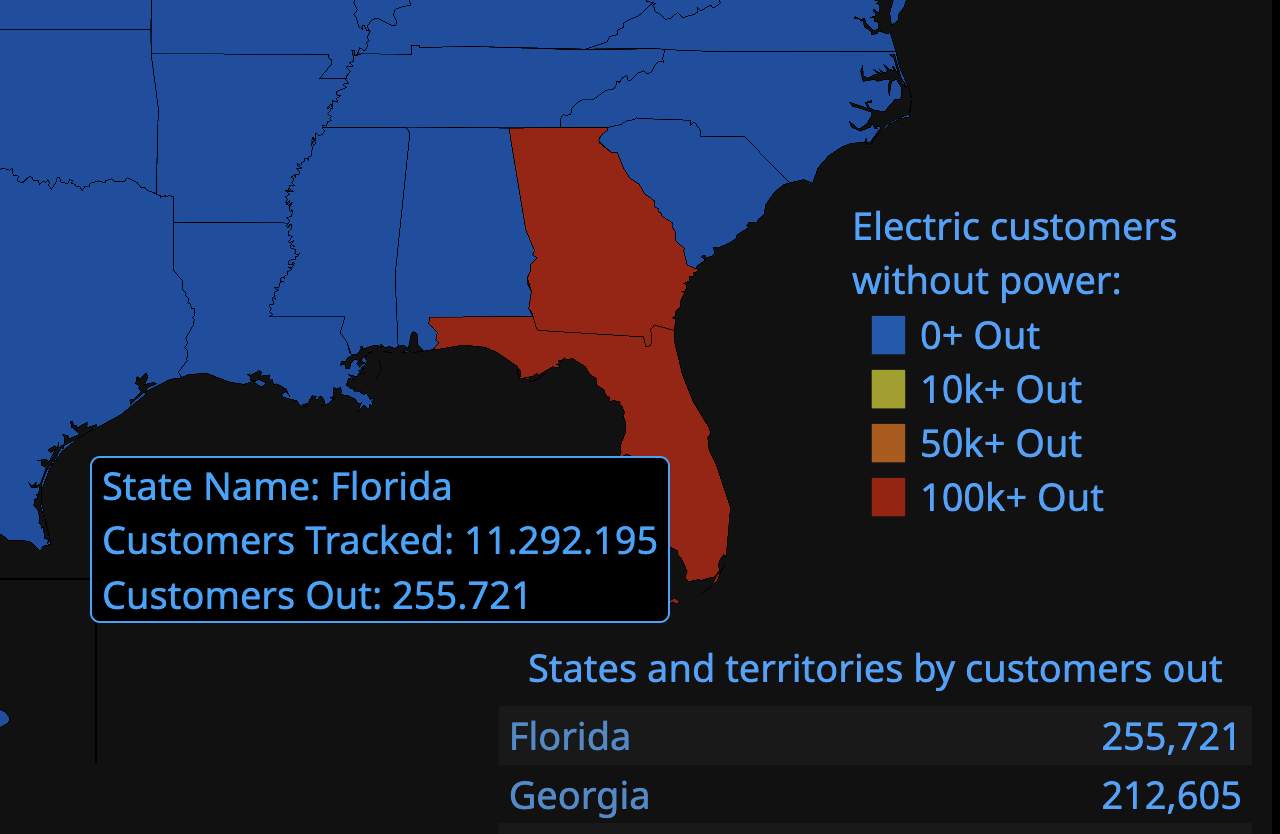
Fig. 1: Several hundred thousand homes in Florida and Georgia are currently without power.; Source: poweroutage.us
Over the past few hours, the hurricane has moved northwards from Florida towards Georgia and then South Carolina, weakening significantly. It is currently at Murtle Beach. In the meantime, however, the storm has lost so much of its strength that it is now categorized only as a tropical storm. As a tropical storm, it is now heading towards the Atlantic. The storm can be tracked in real time on the satellite film.
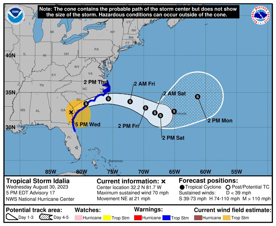
Fig. 2: New trajectory for ex-hurricane Idalia; Source: NOAA
Hurricane Idalia makes landfall today
Idalia rapidly intensified over the exceptionally warm waters of the Gulf of Mexico. This morning, it was already classified as a Category 3 storm. According to the latest data from measurement flights (NOAA Hurricane Hunters), Idalia has probably already reached the lower limit of Category 4. The hurricane can be followed in real time on the satellite film.
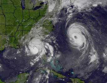
Fig. 1: Hurricane Idalia makes landfall in the "pandhandle" of Florida. On the Atlantic Ocean, Hurricane Franklin is also clearly visible.; Source: SSEC, University of Wisconsin
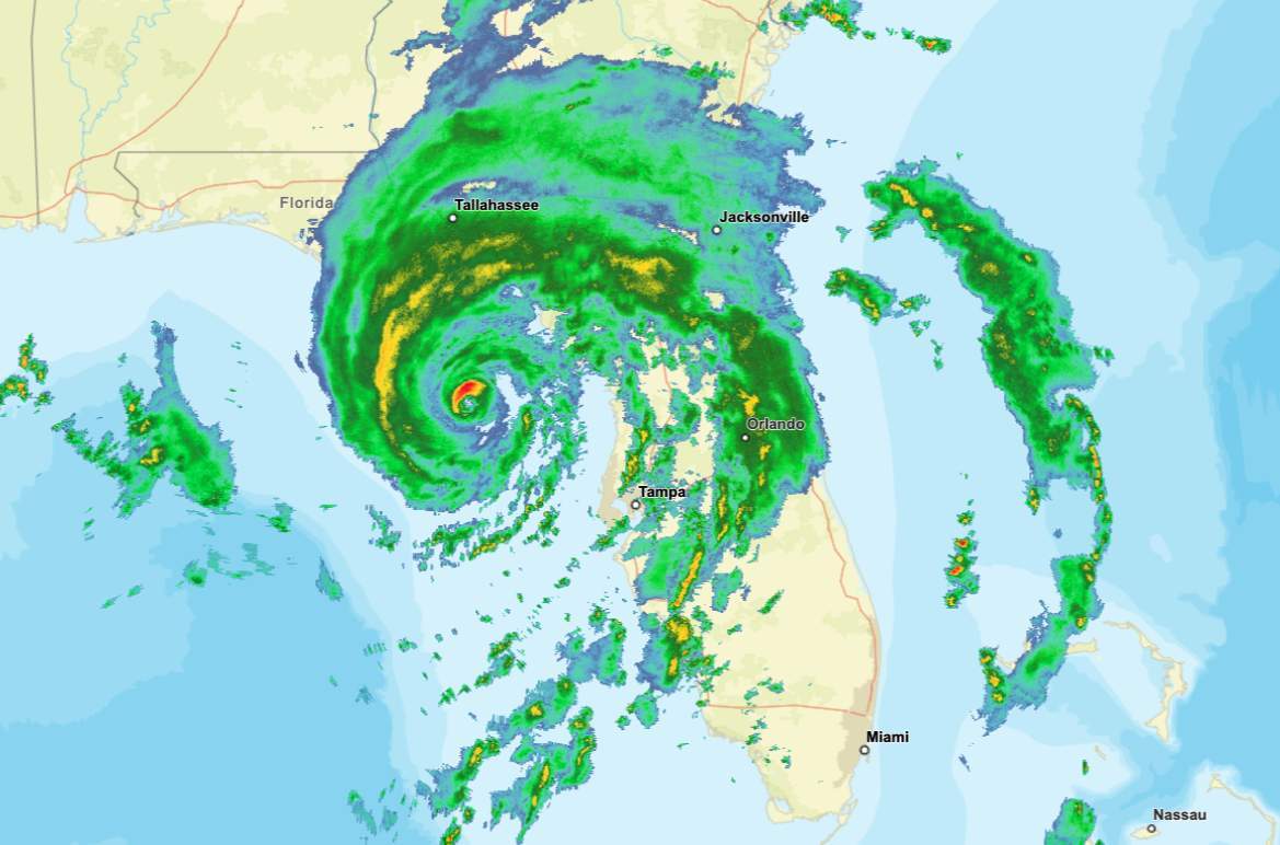
Fig. 2: Current radar image showing rain bands from Hurricane Idalia.; Source: NOAA
Landfall is imminent, with the area between Cape San Blas and the Tampa metropolitan area hardest hit. In addition to the wind, it's the storm surge that poses the greatest danger, with NOAA predicting a rise of 3 to 5 meters!
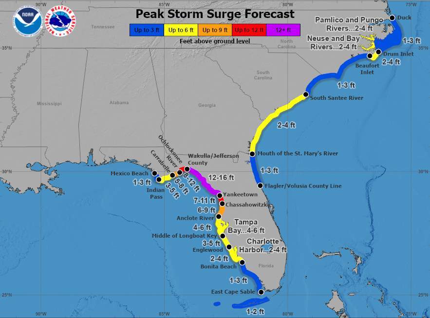
Fig. 3: Expected rise in water level due to storm surge, data in feet; Source: NOAA
The coastal zone here is shallow, so water can penetrate far inland. Intense rainfall is also expected, with outer rainbands already crossing the country. Over the next few hours, Idalia will weaken across southern Georgia, but will probably remain at hurricane strength (at least Category 1). Idalia will then reach South Carolina and southern North Carolina as a tropical storm, before moving out into the Atlantic tomorrow, Thursday.
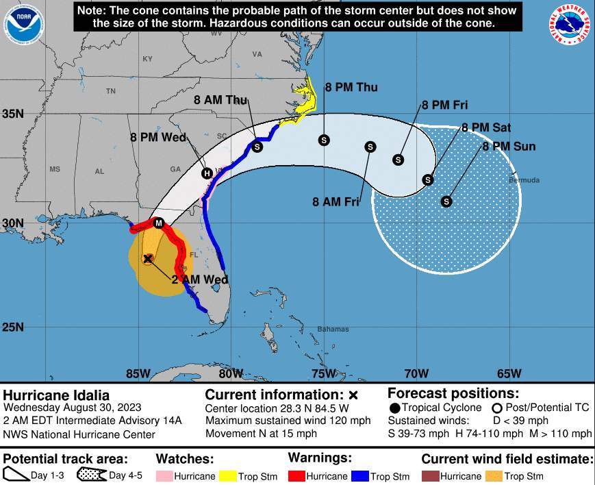
Fig. 4: Hurricane Idalia's alternate trajectory; Source: NOAA
There, the storm will continue to exist for a few days, but models are not yet in complete agreement on its exact behavior. Rainfall along its entire path is expected to be between 100 and 200 mm, while in Florida, in the above-mentioned area, up to 300 mm may fall.
Idalia - Hurricane hits Florida
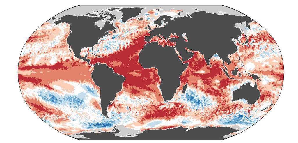
On August 26, a tropical depression formed over the Caribbean Sea (area of low pressure). A day later, the system strengthened somewhat and reached tropical storm status. At the same time, the storm was christened Idalia, the tenth name on this year's list of names. From its birthplace not far from the coast of Honduras, it tracked northwards through Cuba, continuing to strengthen. As of this morning, it is averaging winds of over 121 km/h, which has earned it the designation of hurricane. Although sea temperatures are very warm, sometimes exceeding the norm by more than 2 degrees, Idalia's intensification has not been very rapid in recent days. The reason for this was the differences in winds in the different atmospheric levels. Wind shear - that's the technical term - slows down the development of a tropical storm, as the relatively fragile vertical structure of the storm is somewhat pushed apart or, in extreme cases, torn apart. However, Idalia is arriving in a region of low wind shear, which, combined with warm Gulf waters generally in excess of 30 degrees, creates ideal conditions for rapid strengthening. The hurricane is forecast to make landfall between Tallahassee and Tampa early Wednesday (local time). By then, it is expected to have strengthened into a major hurricane (marked with an "M" in the illustration below), i.e. a category 3 hurricane or higher. Winds of close to 200 km/h are expected, with realistic peaks of over 250 km/h.
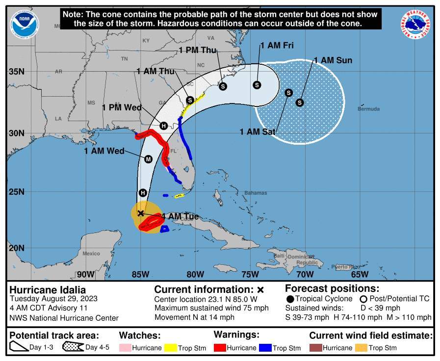
Fig. 1: The Idalia story continues; Source: NWS
Storm surge and tornado risk
Not only strong winds, but also heavy rainfall, high storm tides and tornadoes represent a great danger in the event of a hurricane making landfall. The following illustration shows the expected storm surge heights, sometimes reaching 4 meters. Low-lying areas will be particularly hard hit. We'll keep you posted here.
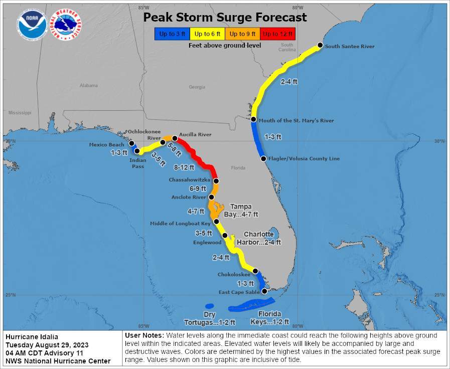
Fig. 2: Storm surge expected in connection with Idalia; Source: NWS
Franklin - no danger for the American continent
Tropical storm Franklin is currently about 600 kilometers north of Puerto Rico. It has been moving northeastwards at a speed of 13 km/h / 8 mph over the past few hours. The system is now turning increasingly north-westerly. Its speed is increasing slightly, reaching around 20 km/h / 12 mph.
At present, Franklin is still a tropical storm, with average wind speeds of around 100 km/h / 62 mph and peak winds of up to 130 km/h / 80 mph. Over the next few hours, however, the system will strengthen and become a Category 1 hurricane on Saturday night. Then, according to current calculations, the hurricane should continue to strengthen over the Atlantic, reaching average winds of 170 km/h / 105 mph and peak speeds of 200 km/h / 124 mph on Sunday night and Monday, allowing it to be upgraded to a Category 2 hurricane. Ultimately, Franklin could even be upgraded to Category 3 with a few extra km/h.
Over the next week, Franklin is expected to remain in the Atlantic, moving north and northeast. As it progresses towards more northerly latitudes, and thus towards less warm surface waters, Franklin should gradually weaken slightly. As Franklin remains in the open sea, this hurricane poses no threat to the American continent. Bermuda should also be only marginally affected.
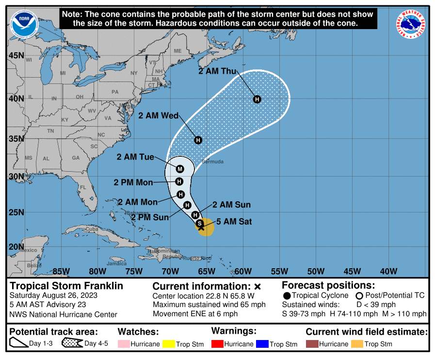
Fig. 1: Hurricane Franklin track forecast (as of Saturday, August 26, 2023); Source: NOAA
New system in the Gulf of Mexico - Idalia
A small area of tropical low pressure is currently located between Mexico's Yucatan Peninsula and Cuba. It is already showing a slight rotation and consists of various thunderstorm cells. A tropical storm is expected to emerge early next week. Since this storm can draw a lot of energy from the surface waters of the Gulf of Mexico, whose temperature is close to 30 degrees Celsius, it is quite possible that this tropical storm will develop into a hurricane. It would then be called Idalia. It remains to be seen to what extent Idalia will strengthen and where it will make landfall by the middle of next week. It is almost certain to occur somewhere along the Gulf coast of the state of Florida.
A very likely scenario is that Idalia will move either as a tropical storm or as a low-category hurricane over northern Florida and then move along the US east coast to the northeast. Densely populated areas would then also be affected. We can only hope that the system will not form sufficiently well and strongly, and that it will at best "only" act as a tropical storm. However, a stronger evolution remains a possible scenario. We'll keep you posted on this site.
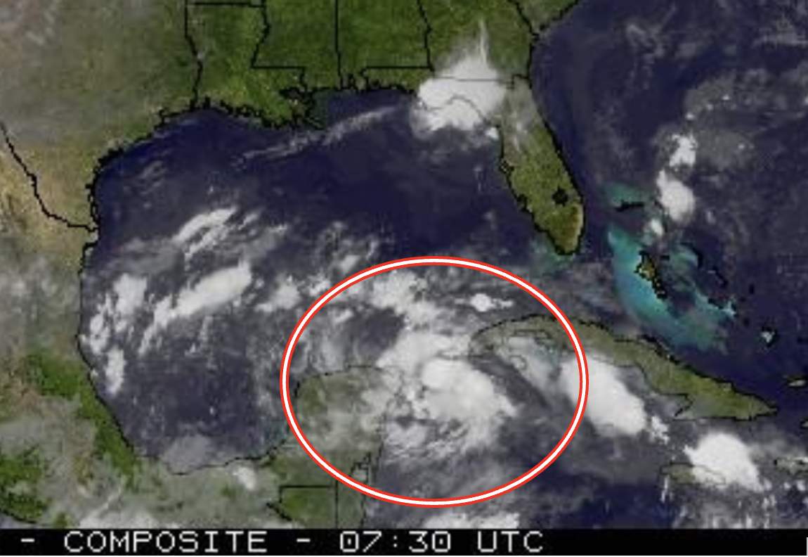
Fig. 2: A new system should soon become a tropical storm.; Source: SSEC, University of Wisconsin
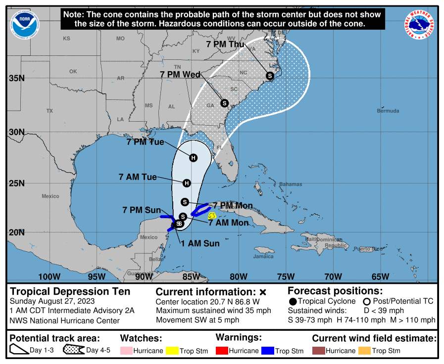
Fig. 3: Predicted track of Hurricane Idalia.; Source: NOAA
Quiet for a month
Since the official start of the Atlantic hurricane season on June 1, one hurricane (Don) and three tropical storms (Arlene, Bret and Cindy) have been recorded. However, for the past month or so, no other system has been recorded.
Increasing risk
As of today, however, hurricane season activity in the Atlantic is higher. Until October 20, the occurrence of hurricanes and tropical storms is set to increase significantly. This greater likelihood will peak around September 10, and then gradually diminish until mid-October.
Emily, Franklin and Gert arrive
Two tropical storms, Emily and Franklin, are on their way across the mid-Atlantic.
Setting out from the coast of Africa, Emily is tracking west-northwest at a speed of 17 km/h. Accompanying winds reached 85 km/h. Emily will be the fifth tropical storm of the season, which is normal for this time of year.
Tropical Storm Franklin is currently located southeast of the Dominican Republic. It is moving at 22 km/h in a north-north-westerly direction. Winds are around 75 km/h. Franklin will be the sixth storm of the season.
Finally, a tropical depression, Gert, has just formed off the north of the West Indies. Forecasts indicate, however, that it will rapidly weaken and dissipate over the next 24 to 48 hours.
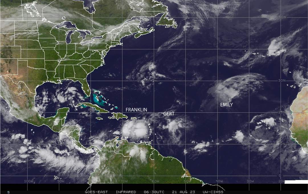
Fig. 1; Source: CIMSS
The list of names will grow
In addition to Don, Arlene, Bret, Cindy, Emily, Franklin and Gert, NOAA, or the National Oceanic and Atmospheric Administration, which manages the list of names assigned to storms or hurricanes in the Atlantic, already has a list of future names in the queue: Harold, Idalia, Jose, Katia, Lee, Margot, Nigel, Ophelia, Phillipe, Rina, Sean, Tammy, Vince and Whitney.
Note that for Atlantic hurricanes, there is a six-year list of names. In other words, a list is repeated every six years. A change only occurs when a tropical phenomenon is so deadly or costly that future use of its name for another phenomenon would be inappropriate for obvious reasons of sensitivity.
disclaimer
The content of this article has been at least partially computer translated from another language. Therefore, grammatical errors or inaccuracies are possible. Please note that the original language version of the article should be considered authoritative.

